The smallest country in Africa by landmass is an Island called Seychelles. However, the smallest country on the mainland is The Gambia. Africa is the second-largest and second-most-populous continent in the world after Asia.
The continent is bordered by the Atlantic Ocean, Mediterranean Sea, Red Sea, and the Indian Ocean. Its land area is approximately 30,365,000 square km. It has 54 countries fully recognized by the United Nations, 2 independent states, and several territories controlled by non-African countries.
Smallest Countries in Africa
1. Seychelles
- Capital City: Victoria
- Land Mass: 455 km²
- Population: 98,462
- Independence: June 29, 1976
- Official Languages: French, English, and Seychellois Creole
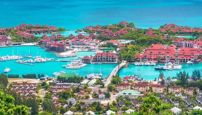
Not only is Seychelles the smallest country in Africa, but it is also one of the most beautiful locations on the continent. It is an Island located in the western Indian Ocean.
The country has a land mass of 455 km² and is famous for its beautiful chain of Islands. Seychelles is among the world’s leading countries to protect lands for threatened species.
The Island has no indigenous people, as most of them are descendants of immigrants who moved there, during the Napoleonic wars. However, the largest ethnic groups found in Seychelles are Africans, French, Indians, and Chinese.
Fun Fact:
Seychelles has up to 115 different islands, some of which are still inhabited. The biggest Island is Mahé which has become the choicest destination for tourists.
2. São Tomé and Príncipe
- Capital City: Sao Tome City
- Land Mass: 1,001 km²
- Population: 219,161
- Independence: July 12, 1975
- Official Languages: Portuguese, Forro, Angolar, and Principense.
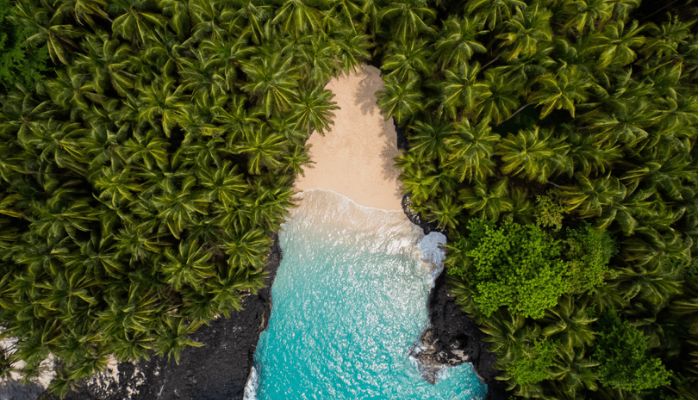
The Democratic Republic of São Tomé and Príncipe is an island country located on the western equatorial coast of central Africa. It consists of two main islands, Sao Tome and Principe which were formed over 30 million years ago during the Oligocene era.
The country was named after St. Thomas the Apostle and the Prince of Portugal.
It is the second-smallest and second-least populous in Africa, with a landmass of 1,001 km². Just like Seychelles, the islands were inhabited until they were discovered by Portuguese explorers in the 15th century.
The country gained its independence from Portugal on July 12, 1975, and has 4 official languages, Portuguese, Forro, Angolar, and Principense.
Fun Fact:
Despite being a small country, São Tomé and Príncipe is rich in biodiversity. It boasts of several native animals including the Sao Tome shrew, various species of bats, the smallest ibis in the world, and the largest sunbird in the world.
3. Mauritius
- Capital City: Port Loius
- Land Mass: 2,040 km²
- Population: 1.266 million
- Independence: March 12, 1968
- Official Languages: English and French
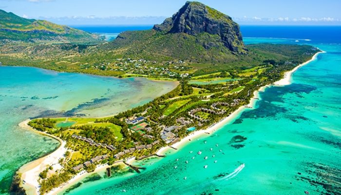
Officially known as the Republic of Mauritius, it is an island located in the Indian Ocean and was first discovered by Arab sailors. It was first called Dina Arobi.
The island has been controlled by different ethnicities including Portuguese sailors, the Dutch, and the French. It was renamed “Isle de France” before it was seized by the United Kingdom.
The country has a land mass of 2,040 km² and is the third smallest country in Africa. It has 9 states.
Mauritius gained its independence from the United Kingdom on March 12, 1968, and became a republic on March 12, 1992. Its official languages are English and French.
Fun Fact:
Mauritius has two UNESCO Worl Heritage Sites, the Aapravasi Ghat and Le Mome Brabant.
4. Comoros
- Capital City: Moroni
- Land Mass: 2,235 km²
- Population: 869,595
- Independence: December 22, 1974
- Official Languages: Comorian, Arabic, and French
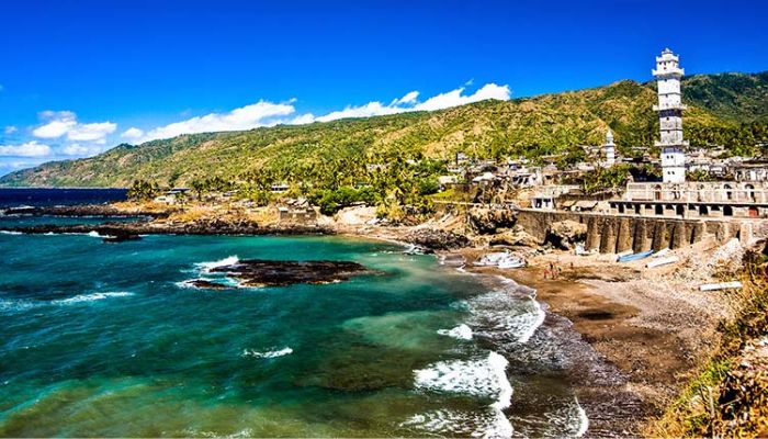
The Union of Comoros is an island located in the Indian Ocean off the east coast of Southern Africa. It is located between Mozambique and Madagascar. The island consists of three major islands, Ngazidja, Nzwani, and Mwali, and numerous smaller islands.
The name Comoros originated from the Arabic word “Juzur al Qamar” which means “Islands of the Moon”.
It has a total landmass of 2,235 km². Its first settlers of the island were Austronesian settlers, then it was colonized by the French. It was a French colony and part of the island of Mayotte until its independence on July 6, 1975.
Comoros was declared the Federal Islamic Republic of Comoros on October 1, 1978, and later, the Union of Comoros on December 23, 2001. Its official languages are Comorian, French, and Arabic.
Fun Fact:
The country has a unique flora which is attributed to the “ylang-ylang” or perfume tree. The tree is used to produce essential oils and perfumes.
5. Cape Verde
- Capital City: Praia
- Land Mass: 4,033 km²
- Population: 555,988
- Independence: July 5, 1975
- Official Languages: Portuguese, English, and Cape Verdean Creole
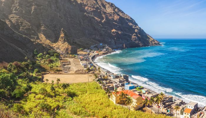
The Republic of Cabo Verde is an archipelago, a chain of islands, located in the central Atlantic Ocean. The Island boasts of 10 volcanic islands with a combined land mass of 4,033 km². Its islands are divided into the Barlavento and Sotavento Islands.
The archipelago was inhabited until the 15th century when it was discovered and colonized by Portuguese explorers. Cape Verde because of its location, played a vital role in the trans-Atlantic Slave Trade. Its involvement in the slave trade caused its economy to boom and it suffered after the slave trade was abolished.
Cape Verde gained its independence from Portugal on July 5, 1975. Its official languages are Portuguese and Cape Verdean Creole.
Fun Fact:
There are more Cape Verdeans living outside Cape Verde than in the country.
6. The Gambia
- Capital City: Banjul
- Land Mass: 11,300 km²
- Population: 2.417 million
- Independence: February 18,1965
- Official Languages: English
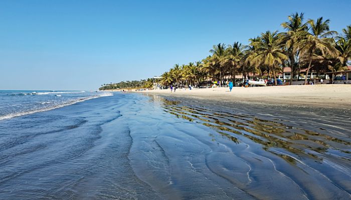
The republic of The Gambia is the smallest country in mainland Africa. It is surrounded by Senegal and the Atlantic Ocean. The country is located on both sides of the Gambia River from which the country gets its name. The river empties into the Atlantic Ocean.11.5% of the country’s area is covered by water.
The widest point in the country measures about 30 miles and the entire country has a land mass of 11,300 km².
It was formerly known as the Senegambia confederation, which was a loose confederation between Gambia and Senegal. However, Senegambia was dissolved on September 30, 1989, and the Gambia became a country of its own.
The country was in the center of the slave trade and has a museum to educate people about the history of the trans-Atlantic slave trade in the area.
It gained its independence from the United Kingdom on February 18, 1965. The Gambia’s official language is English and the major source of income is Farming and fishing.
Fun Fact:
The Gambia is also called a birdwatcher’s paradise due to its large collection of birds. The country has 540 species of birds in its forests and river banks.
7. Eswatini (Swaziland)
- Capital City: Mbabane (Executive) and Lobamba (Legislative)
- Land Mass: 17,364 km²
- Population: 1.16 million
- Independence: September 6, 1968
- Official Languages: Swazi and English
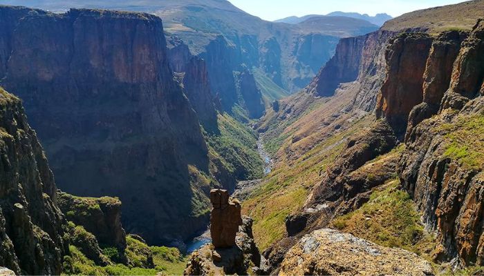
Swaziland is a small landlocked country, bordered by South Africa and Mozambique. It covers an area of 17,364 km². It was officially renamed the Kingdom of Eswatini in 2018.
The first settlers of the country were Khoisan hunter-gatherers. However, they were largely replaced by the Nguni during the great Bantu migrations, when people originated from the Great Lakes region of central and eastern Africa.
The government is an absolute monarchy and the last of its kind in Africa. It has two capitals, Mbabane, the executive capital, and Lobamba, the legislative capital. Its official languages are Swazi and English.
Fun Fact:
Eswatini is one of the few places where black and white rhinos co-habit close to each other
8. Djibouti
- Capital City: Djibouti City
- Land Mass: 23,200 km²
- Population: 988,002
- Independence: June 27, 1977
- Official Languages: French and Arabic
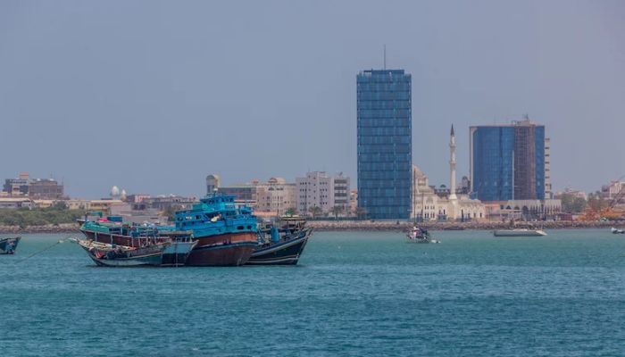
Officially the republic of Djibouti is a country located in the Horn of Africa. It is bordered by Somalia, Ethiopia, Eritrea, The Red Sea, and the Gulf of Aden. The country has a land mass of 23,200 km², which makes it the 8th smallest country in Africa.
It was dominated by the French during the “scramble for Africa”, and became part of the french colony of Somaliland between 1888 to 1977. It later became the capital in 1894.
The country was renamed the “French Territory of Afars and the Issa”. It is referred to as the most urbanized country in sub-Saharan Africa. Djibouti gained its independence from France on June 27, 1977. Its official languages are Arabic and French.
Fun Fact:
Lac Assal, a crater lake in Djibouti is the second saltiest water body in the world. It is 10 times saltier than the sea. It is also the lowest point in Africa and the 3rd in the world, after the Dead Sea and the Sea of Galilee.
See Also: The Largest City In Africa: Lagos And 9 Others
9. Rwanda
- Capital City: Kigali
- Land Mass: 26,338 km²
- Population: 12.95 million
- Independence: July 1, 1962
- Official Languages: Kinyarwanda, English, French, and Swahili
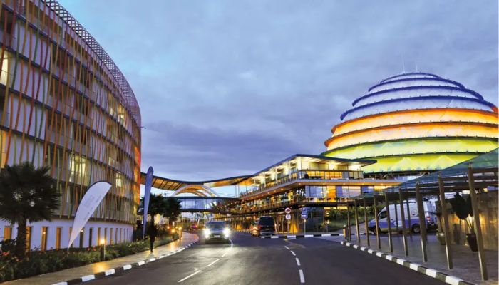
The Republic of Rwanda is a landlocked country in the Great Rift Valley of Central Africa. It is the smallest country in East Africa occupying 26,338 km². It is also the most densely populated country on the continent.
Its first settlers were Twa hunter-gatherers, and later Bantu people migrated to the country for farming. During the Berlin conference of 1884, the territory was a German Empire, and it was declared part of German East Africa.
In 1894, Rwanda and Burundi were combined by Germany as one territory called Ruanda-Urundi, until it got its independence from Belgium in 1962. Its official languages are Kinyarwanda, French, English, and Swahili.
Fun Fact:
The capital city of Rwanda is the cleanest city in Africa as the government observes sanitation every Saturday and has banned the use of plastic bags and sachets for environmental protection.
10. Burundi
- Capital City: Gitega
- Land Mass: 27,834 km²
- Population: 11.89 million
- Independence: July 1, 1962
- Official Languages: French, English, and Kirundi
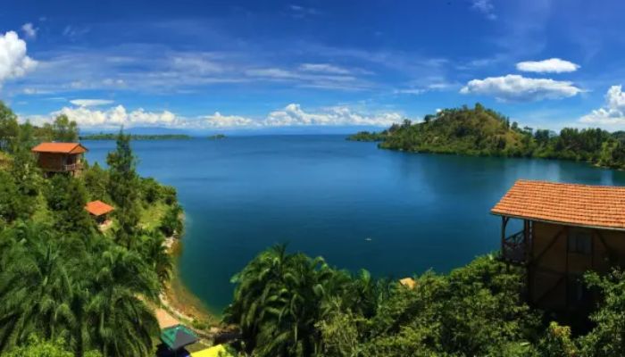
The Republic of Burundi is a landlocked country situated in the Great Rift Valley, where the African Great Lakes region and East Africa converge. It has a land mass of 27,834 km² and is bordered by Rwanda, Tanzania, DR Congo, and Lake Tanganyika.
After the Second World War, it was transformed into a United Nations Trust Territory. It was ruled by the Germans and Belgians as Ruanda-Urundi. They have been under common rule until the time of the European invasion of Africa.
It gained independence from Belgium on July 1, 1962, and became a republic on 28 November 1966. Its official languages are Kirundi, French, and English. Burundi has 2 capital cities, Gitega, the political capital, and Bujumbura, the economic capital.
Fun Fact:
Lake Tanganyika is the world’s longest freshwater lake, the second-deepest, and the second-largest in volume. It is also the second-largest of the African Great Lakes after Lake Victoria
11. Equatorial Guinea
- Capital City: Malabo
- Land Mass: 28,051 km²
- Population: 1.403 million
- Independence: October 12, 1968
- Official Languages: Spanish, Portuguese, and English
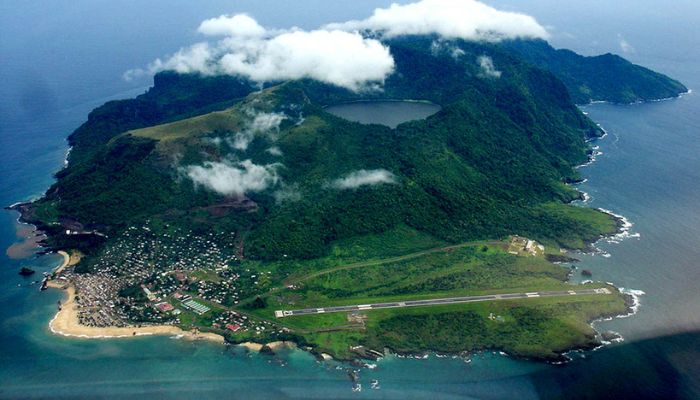
The Republic of Equatorial Guinea is a small country on the west coast of Central Africa with a land mass of 28,051 km². It was formerly known as the colony of Spanish Guinea.
The Portuguese were the first to come to the country and they colonized in 1474. They were handed over to Spain and became a Spanish colony after Portugal signed a treaty with King Charles of Spain.
Equatorial Guinea received its independence from Spain on October 12, 1968. Its official languages are Spanish, French, and Portuguese. It is the only African country to have Spanish as an official language.
Fun Fact:
The Pygmies of Equatorial Guinea are the shortest people in the world. Their height is about half of the height of an average human, and some of them only reach the knees of an average man.




Discussion about this post